

This is a continuation of my 2012-2013 Winter Forecast. Part 1 can be read here.
When it comes to long range forecasting, there are few things more useful than global atmospheric or oceanic patterns. Examples of these patterns include ENSO (El Nino/La Nina), Arctic Oscillation (AO), North Atlantic Oscillation (NAO) and the Pacific Decadal Oscillation (PDO) among many others. What do these patterns that take place thousands of miles away tell us about the winter here? Values of these patterns can be correlated to temperature or precipitation in locations around the world thus giving us an indicator of what can be expected here.
*Please remember going forward that a large negative correlation is just as meaningful as a large positive correlation, it is “no correlation” that is of little help.
ENSO
El Nino/Southern Oscillation (ENSO) is the most famous of the large scale patterns. During the mid to late 90’s it was the buzz word of choice on the Weather Channel and was blamed for everything from floods to a warm day. Of course, we all know better than to blame a single event on one of these large scale patterns, or at least you will know better if you follow this blog.
So what is the correlation of ENSO to precipitation and temperature in SEPA?
In the case of precipitation, the warm colors (reds, oranges, greens) signify increased precipitation during el nino events and decreased precipitation during la nina cases. For temperature the warm colors indicate warm temperatures during el nino and cool temperatures during la nina.


Precipitation (left/top) has a very slight positive correlation for the months of Nov-Mar while there is no correlation to temperature (right/bottom). Not much help in determining our forecast here, but what if we only concentrate on the big snow producing months (Jan-Feb).


We see a very high correlation gradient in precipitation (left/top) and a slight negative correlation in temperature(right/bottom). Again, due to the low correlations, this is not too much help in determining a confident snow forecast for the winter.
Current ENSO Conditions/Forecast
Currently, the equatorial pacific is in a neutral/weak el nino pattern and is forecast to remain in this pattern for the majority of the winter, with a slight chance to go into full weak el nino. Meaning, with the correlations to precipitation it would have almost no effect while temperature might be slightly cooler than normal.
The combination of weak correlation and the forecast of a neutral to weak el nino leads to an inconclusive forecast. If this information was the only available data, then the forecast would have to be “equal chances”, which is in my top 10 most hated terms in forecasting.
It should be noted here though, that no two ENSO years are exactly the same. The difference between a weak and a strong el nino can play a large role in how the winter sets up. An article from Accu-weather has a great graphic showing the differences between weak and strong el nino winters. They have shown that weak el nino conditions typically set up well for snow lovers in the North East.
Conclusion: The past history of weak el nino’s has me adding slightly to the totals for both Philadelphia and Allentown.
PDO
Sticking with the Pacific, next is the Pacific Decadal Oscillation Unlike ENSO, this pattern is centered in the north Pacific and has a longer period, ranging for about 20 to 30 years. Over the past decade or so, the PDO has trended much more negative than in the previous 20. Correlations are much more useful in the case of PDO compared with ENSO.


Top: Whole Season Precipitation. Bottom: Whole Season Temperature


Top: Jan/Feb Precipitation. Bottom: Jan/Feb Temperature
PDO Conclusions
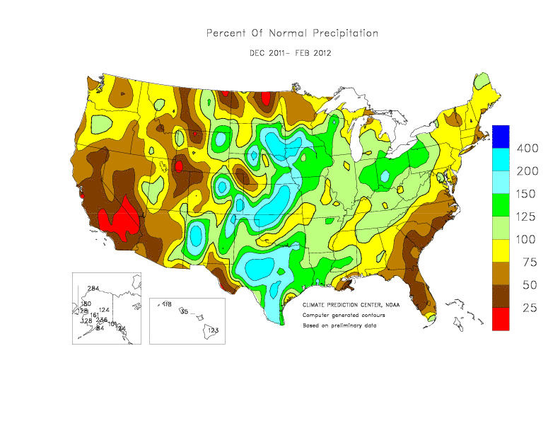
A large negative correlation with temperature is shown in much of the eastern and southern US, especially on the gulf coast meaning that these locations would see warm temperatures during negative PDO phases such as the one we are currently in. As for precipitation, comparing last winters precipitation vs. normal (Pictured here) and knowing that the PDO was very negative you can see that the two maps looks very similar with precipitation falling int he central states while the SouthEast and East were very dry.
This year, the August PDO number was -1.93, and it is unlikely that it would rise into positive territory. Based solely on PDO numbers, this winter could be quite warm and dry, much like last winter.
Due to the warmth associated with a negative PDO, I am lowering the forecast for Philadelphia and Allentown.
AO and NAO
The last of the tele-connection patterns I will highlight are the Arctic Oscillation (AO) and North Atlantic Oscillation (NAO), which are watched closely throughout the winter season. Last year the AO was very strongly positive, while in 2009-10 it was very negative. The same was true for the NAO during both situations. Snow lovers rejoice when these two indices go negative.
When the NAO goes negative you hear the term “blocking” frequently mentioned by atmospheric scientists. This blocking is useful in that it forces storms to remain tight to the east coast rather than racing out to sea. When these storms remain close, it greatly increases the likelihood of large snow storms and nor’ easters. Combine this with a negative AO which allows more cold air to escape the polar region and you have the recipe for snow.
AO/NAO Conclusion:
Unfortunately for me, these two indices are tough to forecast out more than a few weeks, but based on trends, I feel that the NAO will be slightly negative going into the winter while the AO looks to be trending positive.
I think that we will see more storms this year, but the temperature will be a big sticking point. I want to up both snow forecasts but not considerably.
Final Conclusion from Part 2
Based solely on the tele-connections my forecast is that the winter will be above normal temperature wise. The increased likelihood of storms increases the chances that snowfall will be up over last year, but by how much remains a sticking point. Always remember, no single index can explain everything about a season.
Based on history and tele-connections, my forecast for Allentown will be slightly below normal (25″ or so) and that Philadelphia will remain well below normal (13″ or so).
I have to repeat what I mentioned after part 1, this is not my final forecast. I have a few more things that need to be looked into before finalizing my forecast.
Next up is the third part of my winter forecast series, and will show a more national view of how I think the winter will play out. Following part 3 will be the fourth and final post in the winter forecast series, it will outline what makes for a large snow event on the east coast and I will release my final snow forecast for the winter of 2012-13.
Trackbacks/Pingbacks